Ok, so you’ve done the brewery tours, eaten at some amazing restaurants and maybe even caught a sunset or sunrise from the Blue Ridge Parkway. All of those are great things to do in Asheville but if you want to up your adventure a little more, we recommend trying one of our best hikes near Asheville. Keep reading to see our top picks for where to get some miles in under your boots while you’re in town.
Catawba Falls

This was the hike that made me fall in love with Asheville. It’s about 45 minutes outside of town but it’s an easy drive and once you get a little ways down the trail you’re guaranteed to pretty much forget the drive as you’ll be making your way down the easy path, over a wooden bridge and then in hardly any time at all, hanging out at the falls! They’re gorgeous no matter the time of year. We’ve seen them in all different seasons, even in the winter when they were frozen into big icicles. The parking lot has been expanded and updated in the last couple years but it’s still best to get there early if you want to avoid the crowds.
Catawba Falls Trail Info: About 1.3 miles out (2.7 miles roundtrip). A mixture of gravel, wooden bridges (there are two), dirt and roots.
Max Patch
Another big local favorite hiking spot is Max Patch. The Appalachian Trail runs through Max Patch as well as a few other spur trails. You can make the Max Patch Loop Hike, also known as TR 306, which from the parking lot is just shy of 1.5 miles. You can also do an out and back hike and hike as much or as little as you want. Some of the trails leading up to the summit have been sectioned off with signs and even a section of fence. Please #leavenotrace and stay on the designated trails to keep this place as healthy as possible.
Pro tip: Make sure you’ve downloaded directions or at least taken a screenshot of them before you leave because you are almost guaranteed to lose a signal on your way there and signage is almost all but non-existent until you arrive at the parking lot. Also, watch out for lightning storms as they can creep up quickly and be very dangerous to anyone on the exposed bald.
Max Patch Trail Info: The Max Patch Loop Hike is about 1.5 miles long. It’s mostly dirt.
Sam Knob Trail
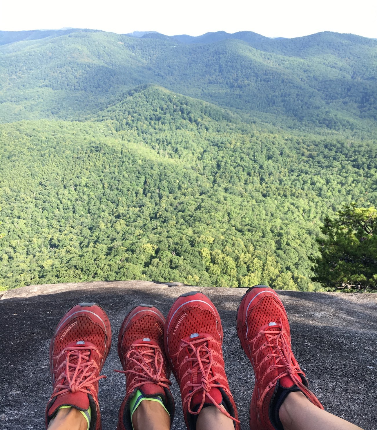
I think I called this hike Sams Knob for about a year before I realized it was really Sam Knob. Could it have been the 6045 feet of elevation? Haha, nah, I was just saying it wrong. But the views and the hike are spectacular and makes it an easy pick for our Best Hikes Near Asheville list. The trail itself is about 2.2 miles long and will take you to the top of the bald where you’ll be rewarded with some amazing views. The start is one of the most picturesque scenes in western North Carolina, especially at sunset because you’ve got a boardwalk that drops down into a meadow which, if you’re lucky, will be filled with wildflowers and tall grasses. Look for the signs that say Sam Knob Summit Trail and then hike your way to the top!
Sam Knob Trail Information: 2.2 miles long, mostly dirt with a cool stepped, boardwalk section.
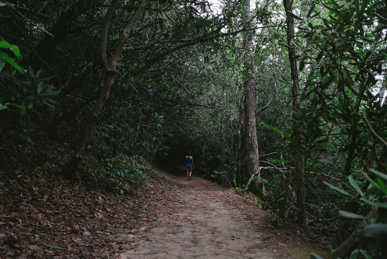
Craggy Pinnacle Trail

When we want to go for a drive along the Blue Ridge Parkway and then stretch our legs somewhere, we almost always head for Craggy Gardens Pinnacle. The drive from downtown Asheville is about 20 miles and will take about 40 minutes if you go the speed limit and don’t stop at any overlooks. We recommend padding your schedule with a little extra time so you can pull-off and check out a few of the views.
The hike to the summit is short but moderately intense. You’ll be climbing up, through rhododendrons that in the spring and summer, make you feel like you’re walking through a green tunnel. There are a couple of great panoramic views along the way up but keep pushing until you reach the true summit. You’ll be rewarded with 360 views and cars that look the size of ants! If you time it right, you may just see the most sunrise or sunset of your life. This is easily one of the best hikes in the Asheville area.
Craggy Pinnacle Trail Info: It’s about .7 miles to the overlook at the top. The trail is an out and back trail (1.4 miles roundtrip) and mostly dirt with a fair amount of rocks and roots.
Mount Pisgah
My very first hike in the the Asheville area was the hike up Mount Pisgah. This was about a decade before I actually moved to Asheville. Once I moved here, it was the first hike I did on my own. I really couldn’t remember much about my first time up there but I’ve repeated the hike several times now because it’s a fun distance to do alone or with friends. And the view up there isn’t bad either! At just over 2 miles, roundtrip, it’s a great hike to do when you’re just getting into town, just getting into town, or you want to have a small adventure before pushing off for home. The view up there is pretty spectacular so be sure to bring a camera. Also, this is one of the most popular trails in the Asheville area so be sure to hit it early or be ready to contend with crowds.
Mount Pisgah Trail Info: This trail is about 1.1 miles to the overlook (2.3 miles roundtrip). It’s a good combination of roots, dirt, and rocks.
Graveyard Fields
Waterfalls, rhododendrons, boardwalks and … toilets at the trailhead! You can get to the first waterfall, Lower Falls, in about .3 of a mile. It’s an easy photo op for your Instagram feed. If you want a longer hike, continue on the Graveyard Fields Loop.
Graveyard Fields Trail Info: Lower Falls is a short .3 mile hike away from the parking lot. Graveyard Fields Loop is another 3.5 mile trail that you can access from the first short trail. You can expect steps, wooden bridge sections, dirt, rocks and roots. Beware of slippery sections.
Devil’s Courthouse
This short hike comes in at about 1 mile roundrip. Most of the trail is paved but it is steep! Don’t be deceived by the distance and come here if you’re looking for something flat and easy. That said, those of you who are able to make the short but intense climb will be rewarded with views from 5720 feet! On days without fog or haze you may be able to see as far as South Carolina, Tennessee and Georgia. To know what you’re looking at, head for the bronze plaques up there. This is a short hike in the Asheville area, but it’s also one of the best.
Devils Courthouse Trail:
Black Balsam Knob
There are tons of hikes in Pisgah National Forest but this is one of our favorites. Black Balsam Knob is is one of the most amazing hikes in the Asheville area. If you liked Max Patch, you’re going to love Black Balsam Knob because it, too, is a bald. Like Max Patch, you’ll be rewarded with incredible views that extend for miles. Depending on the time of year you’re likely to see wildflowers and even blueberries. Plus you’ll get a chance to hike on the famous Art Loeb Trail. The summit of Black Balsam Knob sits at 6,214 feet! Oh and bring sunscreen as there is very little shade up here.
Note: Black Balsam Knob Road, FS 186, is located off the Blue Ridge Parkway. The trailhead itself is located off this road.
Black Balsam Knob Trail Info: It’s only .7 miles from the parking area off the Blue Ridge Parkway to the summit. Unless you are there really early, you will have to contend with crowds so consider leaving Asheville in the dark. Expect dirt and rocks.
Looking Glass Rock Trail
This is one of the longer trails on our list of the best hikes in the Asheville area. It’s not to be confused with Looking Glass Falls Hike although that one is great, too. This one takes you up about 1,700 feet in about 3.2 miles. The elevation at the top is 3969 feet. It’s not the highest spot in the area, but it is one of the coolest. After about two miles you will come to an overlook which is basically just a big, flat rock. It also doubles as a helipad. It’s a good spot for a snack or a water break but keep going, this isn’t the summit! Also, bewared: There aren’t any fences or ropes up on the bald so use caution and stay away from the edge.
Looking Glass Rock Trail Info: This hike is 3.2 miles (6.4 miles roundtrip). It’s a fairly steady climb to the top but it’s an out and back trail so you can cruise coming back to your vehicle. You can expect switchbacks, dirt, rocks, and roots.
Bent Creek to the NC Arboretum
This is not the most scenic trail network in Asheville. I repeat, this is not the most scenic trail network in Asheville. But it made our list of the best trails in the Asheville area because it’s close to town and it’s multi-use. It’s open to hikers, runners and mountain bikers. It’s also a great area for families with kids. There are numerous trails to take from the Hard Times parking lot. That one is often full. If so, you can try parking at the Ledford Branch Trailhead and even backtrack to the Rice Pinnacle Trailhead. Both are fun. If you want to stay on a relatively flat section, you can even hike all the way to the Arboretum, provided the gate is open. Beware that your cell phone doesn’t work in most areas of Bent Creek so don’t rely on it for navigation. (See maps below).
Bent Creek Trail Info: There are a lot of great miles in this area which can be fun if you want to hike, run or ride for miles. That said, it can be easy to get lost. We recommend getting a detailed map before heading out in this area rather than relying on signs along the way.
Additional Hiking in Asheville Resources


Best Hikes in the Asheville Area Recap
There are so many places to go hiking in Asheville that it can be a bit overwhelming knowing where to start. That’s one of the main reasons we decided to create this list of the Best Hikes in the Asheville Area. Most of the hikes on this list are short hikes in Western North Carolina area but almost all of them are near to other trails which can be linked up for additional mileage. This list, however, is nowhere near the end-all, be-all of hikes. In fact, these are some of the best hikes in the area but they’re also some of the most popular. Once you’ve visited them, you’ll probably want to get a little more off the map and visit some of the lesser known, but no-less cool, spots near Asheville.
How many of these hikes have you done? We’d love to hear from you. Please feel free to share, like, pin or save for later.
Want to know where to grab a coffee in Asheville pre-hike or a beer in Asheville post hike? Maybe you love it here so much you’re considering moving to Asheville. We’ve got you covered with these topics and more on our Asheville page.
Oh and if you liked this, be sure to check out our post on Best Places to Hammock Near Asheville, North Carolina!
Erin McGrady and Caroline Whatley are travel writers, photographers and the authors of Authentic Asheville.
3 thoughts on “Best Hikes Near Asheville”